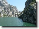
Město: Peshtan-i Math, Region: Fier

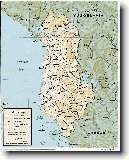
Zpět na článek: Albánie


Navigace mapy Celého Světa online: Kliknutím a tažením na mapě Celého světa, nebo použijte zoom kontrol.

Zeměpisná šířka:

40,6733 (40°40'23.880"N)

Zeměpisná délka:

19,5347 (19°32'4.920"E)

Nadmořská výška:

165 m

Článek: Albánie

Největší města: Albánie

Foto, fotky: Albánie

všechna města: Albánie

Fórum: Albánie

Největší města světa

GMT čas: +1 hodin

Posun oproti ČR: 0 hodin

Vzdálenost města Peshtan-i Math do 25 největších měst státu: Albánie

Přímá vzdálenostKm
 Peshtan-i Math - Tirana  77 km
 Peshtan-i Math - Durres  73 km
 Peshtan-i Math - Elbasani  67 km
 Peshtan-i Math - Vlore  23 km
 Peshtan-i Math - Shkoder  155 km
 Peshtan-i Math - Fier  6 km
 Peshtan-i Math - Korce  105 km
 Peshtan-i Math - Berat  35 km
 Peshtan-i Math - Beligrad  35 km
 Peshtan-i Math - Ljushna Cod A Gomares  33 km
 Peshtan-i Math - Lushnje  33 km
 Peshtan-i Math - Kavaje  57 km
 Peshtan-i Math - Pogradec  98 km
 Peshtan-i Math - Lac  108 km
 Peshtan-i Math - Lac  119 km
 Peshtan-i Math - Laci  119 km
 Peshtan-i Math - Laci  108 km
 Peshtan-i Math - Lac  149 km
 Peshtan-i Math - Gjirokaster  84 km
 Peshtan-i Math - Patosi Fshat  10 km
 Peshtan-i Math - Patos  7 km
 Peshtan-i Math - Kruje  95 km
 Peshtan-i Math - Lezhe  124 km
 Peshtan-i Math - Kucova  42 km
 Peshtan-i Math - Kucove  35 km

Vzdálenost města: Peshtan-i Math do Top 10 měst světa

Přímá vzdálenostKm
 Peshtan-i Math - Praha  1 118 km
 Peshtan-i Math - Berlín  1 397 km
 Peshtan-i Math - Londýn  1 926 km
 Peshtan-i Math - Los Angeles  10 651 km
 Peshtan-i Math - Moskva  2 133 km
 Peshtan-i Math - New York  7 460 km
 Peshtan-i Math - Paříž  1 630 km
 Peshtan-i Math - Peking  7 739 km
 Peshtan-i Math - Rio De Janeiro  9 589 km
 Peshtan-i Math - Sydney  15 733 km
 Peshtan-i Math - Tokio  9 563 km


Navigace: A B C Č D E F G H I J K L M N O P Q R Ř S Š T U V W X Y Z Ž VŠE

Podpořte nás · Kontakt· Kniha návštěv · RoboStav
Copyright (c) 2024 by CELÝSVĚT. Všechna práva vyhrazena!
Kontaktní e-mail: celysvet(zav)email.cz


Peshtan-i Math
Peshtan-i Math


Peshtan-i Math
Peshtan-i Math


Peshtan-i Math
Peshtan-i Math


Peshtan-i Math
Peshtan-i Math


Peshtan-i Math
Peshtan-i Math


Fotogalerie ()...


Přidat foto...


Poradna
Poradna
Poslední dotazy:
HELP !


IQ test online

Hry online
Svátek má  Michal, zítra Jeroným